


It’s been a couple years so I decided to embark on another hike out to Wallula Gap and I’m sure glad I did! It was a beautiful morning, clear and crisp.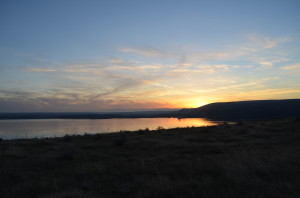 The sun rose over the Columbia River as I was walking through the dried scrub brush. Underneath was a fresh carpet of green as the sure sign that spring is just around the corner!
The hike across the open fields was quiet and peaceful. I was greeted by several grazing cows. It took about an hour to reach Wallula Gap from the trailhead off Ayers Road. Once I scrambled up and down the rolling landscape gouged out by the Ice Age Floods (you can find out more at this link here on hiketricities), the territory become more and more familiar. I got to a communications shack overlooking the river and found
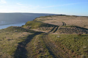
Roadway that stretched out gracefully near Wallula Gap
a well used roadway that snaked across the green scenery, it had a special kind of beauty. As I walked, I came across
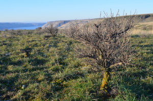
Sagebrush “bonsai” trees along the Wallula Gap Hike
small sagebrush which looked almost like little Bonsai trees. It was apparent they had been thrashed by high winds in this harsh area. I was fortunate to not have any wind on my journey this morning.
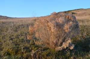
Sunrising on the delicate plants leftover from last year’s growing season
Finally, after ascending and descending draw after draw and gaining considerable elevation,
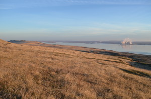
The “Yellipit” area along the Columbia River from the top of Wallula Gap
I got to the highest point overlooking the gigantic chasm shaped by the floods that scoured this area some 10-thousand years ago or more.
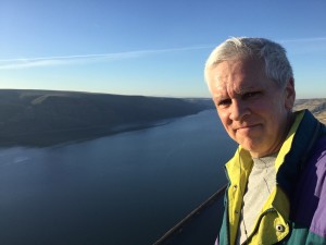
At the top of Wallula Gap
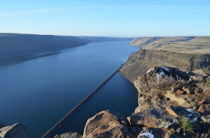
It is awesome to see the 1100 foot shear drop off that goes right down to the Columbia River. The look downriver is awesome as the railroad stretches out.
Looking up the Columbia River from Wallula Gap toward the Boise-Cascade Plant
Upriver is Highway 12 and the Boise-Cascade plant along with Kennewick and Finley. As I headed back to the trailhead, I had a beautiful view of the Twin Sisters in the shadows across the river.
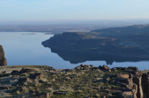
Twin Sisters reflecting in the Columbia River as viewed from the top of Wallula Gap
A great morning hike, about six and a half miles covered in a couple of hours.