■Mileage: 4 miles one-way
■Difficulty: Easy
■Elevation: no elevation gain
Warning: Uneven Surfaces on paved path can be a tripping hazard, hike carefully!
View Bypass Shelter Belt Trail – Richland in a larger map
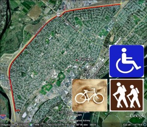
You can get on this trail at a number of places as it crosses several roads along the Bypass Highway in Richland. You can find trail entrances just off the Bypass Highway at Thayer Drive, Duportail, Swift Boulevard, Van Geisen Street and Jadwin Avenue.
This is an enjoyable hike in town along a paved trail so it is suitable for walking, bicycling, strollers and wheelchairs. The south end of the trail is on Thayer at a small park behind Fred Meyer. The north end of the trail is at Jadwin Avenue just north of Stevens Drive.
The trail follows a tree lined area that borders the Bypass Highway (Highway 240). There is a large concrete barrier that blocks most of the highway noise so it is a very pleasant walk that is close to town. The other side of the trail is backyards of neighborhood houses. You’ll get the chance to see many birds, some squirrels and other small animals.
The Bypass Shelter Belt trail covers over 60 acres and also includes garbage cans, benches and water fountains (with doggy dishes) for refreshing breaks along the way.
Enjoy the walk through the trees but be aware of bicycle traffic too! One exciting thing about this trail is the new extension which connects the trail from Van Geisen to Jadwin (about a mile longer than before!).


