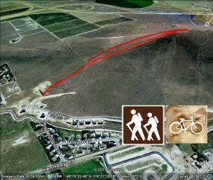
■Mileage: 1.4 miles round-trip, variable
■Difficulty: Difficult, rapid elevation gain
■Elevation: Gain of 784 feet (650 starting elevation, 1434 summit)
View Candy Mountain Trailhead in a larger map
Sunrise on Candy Mountain blog post
Candy Mountain, 3 totally different hikes in 3 days! blog post
To get to the trailhead for this hike on Candy Mountain, take the Queensgate Exit off I-182, go south to Keene Road and drive west just over 2 miles to the roundabout intersection with Bombing Range Road. Go south to Kennedy Road and turn right (west). Go west 1/2 mile, turn left (south) on Candy Mountain Avenue. Go up the hill to Hershey Lane, follow this winding road to a dirt area, park and hit the trail!
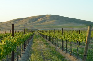
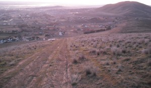
This is a fairly strenuous hike as the old road/trail goes right up the mountain to the top at about 1400 feet high. You’ll park right next to a large water tank and head right up the hill. As you get about a hundred yards up the road, you can take an alternate trail. At the end of the old wooden fenceposts, turn left and go about 20 feet and you’ll see a nice footpath to the top on your right. The vistas of the Columbia Basin open up as you quickly gain elevation on this hike.
As you work your way to the top, there are several “false summits” where you think you’re near the top, only to see you still have a ways to go.As you finally crest the summit, you’ll find a wooden pole, probably leftover communications infrastructure. There’s also an abandoned steel railroad container with a delapidated antenna.
At the top, you’ll have a nice view of West Richland. You can also see Badger Canyon and west to Benton City and the Lower Yakima Valley. This is a nice hike to get your blood pumping. It took me about 15 minutes hiking at a moderate pace.


