■Round Trip Mileage: 2 miles roundtrip
■Difficulty: Difficult
■Elevation: Maximum elevation 939 feet, minimum elevation 776 feet.
■Warning: Rattlesnakes have been spotted on this trail during warm, summer months. Fast running water and steep dropoffs. Keep a close eye on young children & non-swimmers.
This is a state park and has a day use fee of $10.
View Palouse Falls Trailhead in a larger map
Palouse Falls is an awesome geologic feature out in the middle of nowhere northeast of Pasco. To get to the trailhead, take Highway 395 north from Pasco. Go about 32 miles and exit right at Connell. Turn right at the stop sign onto highway 260. Go about 24 miles, past Kahlotus, turn right on Highway 261 (watch for signs to Palouse Falls). Go 8.7 miles to the Palouse Falls turn-off on the left. Go about 2 miles on the gravel road to the park.
Palouse Falls Panorama from Paul Shoemaker on Vimeo.
Palouse Falls State Park is a day-use area and it also has camping available.
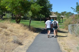
The park has nicely kept facilities with manicured grassy areas, picnic tables and protective shelters. 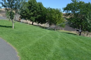
The crowning feature of Palouse Falls is the 198 foot waterfall of the Palouse River. 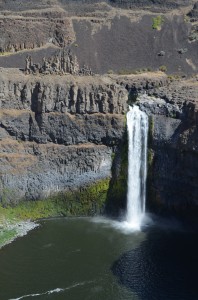 The parking area is right next to the viewing areas with kiosks and information displays explaining how the great floods of Lake Missoula helped create the Channelled Scablands years ago. What makes this area so unique is that it really is miles from any major population areas, in the middle of the desert of eastern Washington.
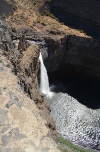
From the main viewing area, you can hike to higher ground for another perspective of the waterfall.
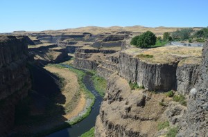
You can also get a great view downriver.
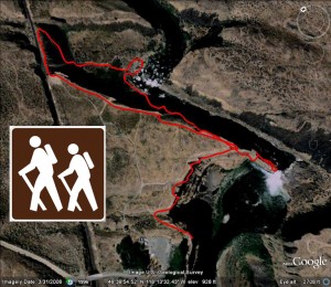
My favorite hike at Palouse Falls is to venture around to the upriver section, above the big waterfall. From the main viewing area display, by the fence, follow the paved path toward the falls and it turns into a dirt trail. Follow the trail up the hill for a great view. Continue out to the point and continue around, you’ll see the upper Palouse River flowing down a deep canyon.
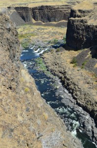
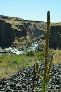
You can continue on the trail along the rim with great views of the upper river and smaller falls.
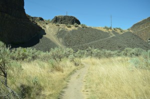
Following the dirt trail will lead you to a steep downhill to the railroad track bed. As you follow the railroad, a beautiful view back down the Palouse River comes into view.
Follow the tracks to a trail that goes diagonal down to the river.
This is challenging and requires sturdy hiking boots or shoes as the rip-rap rock is fairly large and can easily turn ankles.
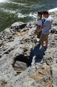
The trail goes to the river, you have to cross some large rock fields as you look across the pool to the small waterfalls.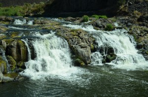 If you look closely, you can see plenty of hydraulic shaping of the basalt with water running high in the spring like this rock that gets churned in this hole.
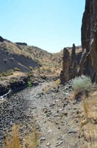
The narrow trail follows the river out to the dropoff of Palouse Falls. The trail is steep and washed out in places so hike carefully. You will end up at what I call the “Fingers” which are rock pillars pointing to the sky.
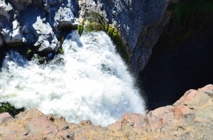
If you get close enough (be very careful), you can look over the waterfall plunging nearly 200 feet to the pool below.
You can also see a great view back to the parking area and down the canyon toward Lyons Ferry. This is a great hike with amazing geologic features. You could spend much of a day here exploring and admiring the area.


