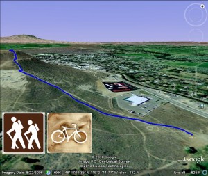
■Mileage: .3 miles, one-way.
■Difficulty: Challenging, frequent rest stops may be needed
■Elevation: 330 foot elevation gain.
View Flattop Trailhead in a larger map
Quick Hike Up Flattop Blog Post
Directions to the trailhead:
To get to the trailhead to hike up Flattop Hill/Mountain, head for West Richland. Pickup Highway 224 off the Bypass Highway 240 that goes around Richland. Go 2.25 miles to the corner of Bombing Range Road. Flattop Park is at the southwest corner of this intersection. You can see Flattop Hill just to the west. Park in parking lot and head on up the hill.
This is a short .3 mile hike to the top but it is pretty much straight up. You’ll climb over 330 feet on this short jaunt. It gets even more difficult in the summer as the trail is sand and gets softer with dry weather. Time to the top can range from 7 minutes to half an hour or more depending on your breaks along the way. At the top is a large cross and you have a great view of West Richland, the winding Yakima River and the Hanford Nuclear Reservation. A quick hike but you can get your heart pounding if you hike fast! I like this hike because it is easy to squeeze into a lunch hour and it does give you a good workout.


