
- One-way mileage: 1.25 miles
- Difficulty: Moderate
- Warnings: Snakes may be out during warm weather
- This hike is mainly suitable for hiking, not bicycling or horseback
Trailhead Directions:
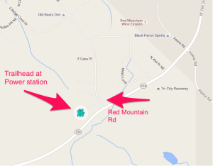
This trailhead is just west of West Richland off Highway 224. Head West on 224 (Van Giesen) from West Richland and turn right on Red Mountain Road about two miles outside of town and just past the old Tri-City Raceway tri-oval. You can also get to Red Mountain Road by heading east from Benton City and turn left on Red Mountain Road just before the raceway. Head north on Red Mountain Road about 500 feet and take the first dirt road on your left (under the powerlines). Go up the road a short distance to the power station and park along the chain-link fence and lace up your hiking boots!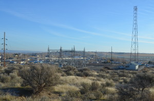
The Hike
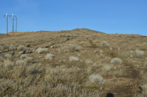
Head west from the power station, through a small sand pit and up the hill on the trail.
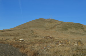
Red Mountain East Hike
You’re heading for the communications antennas on top of Red Mountain.
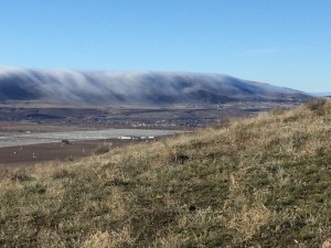
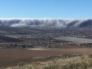
Horse Heaven Hills with foggy blanket, view from the top of Red Mountain
As you hike through the sagebrush on the trail, you may see jackrabbits running around.
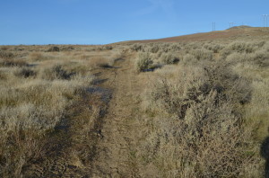
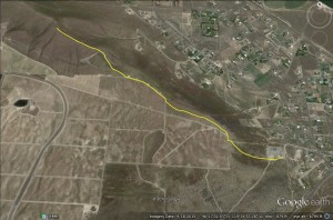
Red Mountain Trail
The trail can be rather sandy. Continue up the hill until you reach a gravel road that borders a vineyard. Turn right and go about 100 feet to where the road turns left.
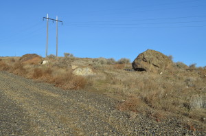
Take this trail off the road by the big rocks.
You’ll see some large rocks and a small trail among the rocks, take the trail and keep ascending through the terrain (its a little rocky but not too difficult). You’ll come to another road, turn right and follow it up the hill.
Trail to the top of Red Mountain
Then, you’ll find another road that veers right, follow it and keep going up the hill. Along that road is an adjacent trail you can follow. Make sure to take time to enjoy the view as you have already gained quite a bit of elevation.
On Top of Red Mountain
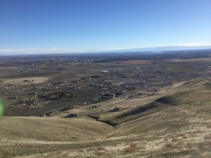
Keep climbing as the incline becomes steeper and you’ll soon be on top. The communication towers are surrounded by chain-link fence (keep out). The view at the stop is awesome.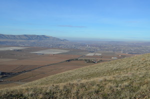 You can see Mount Adams. You’ll see Benton City.
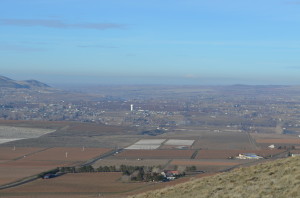
Benton City From the Top of Red Mountain
You’ll see all the Tri-Cities, Columbia River, Hanford and the White Bluffs,
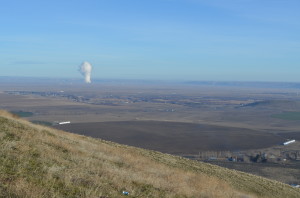
Columbia Generating Station Nuclear Plant and Hanford Nuclear Reservation
the Columbia Generating Station nuclear plant, and Candy, Badger, Rattlesnake Mountains and Goose Hill.
Red Mountain view
On clear days, Mount Adams looms large. On the south side of Red Mountain you’ll see thousands of acres of vineyards and numerous wineries at the Red Mountain American Viticultural Area. Enjoy!
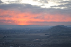
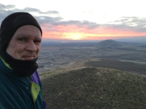
Sunrise